


To further boost maintenance efficiency, it can detect various types of road surface damage, including longitudinal cracks, transverse cracks, alligator cracks and potholes. This automated detection allows for timely maintenance and reduces the risk of accidents.
ScanwAi’s solution - new on the market this year - offers neutral, independent survey and video data embedded with timestamps and GPS coordinates. This improves the quality and reliability of roadworks and road conditions by ensuring precise and verifiable documentation of these conditions.
Meanwhile, an automatic infrabalance feature continuously monitors and adjusts the balance of infrastructure elements including inventory of traffic signs. This ensures optimal performance and longevity of road surfaces, reducing maintenance costs and improving safety.
The overall result, says the company based in Tampere, Finland, is maximum road safety, efficiency and sustainability.
ScanwAi’s customers already include Finland’s Transport Infrastructure Agency as well as city road agencies and private maintenance contractors. ScanwAi has also been selected to join Urban Tech Helsinki, a high-tech incubator programme in Finland, managed by Aalto University, one of the country’s leading technology universities.
Stand H7-G13


")


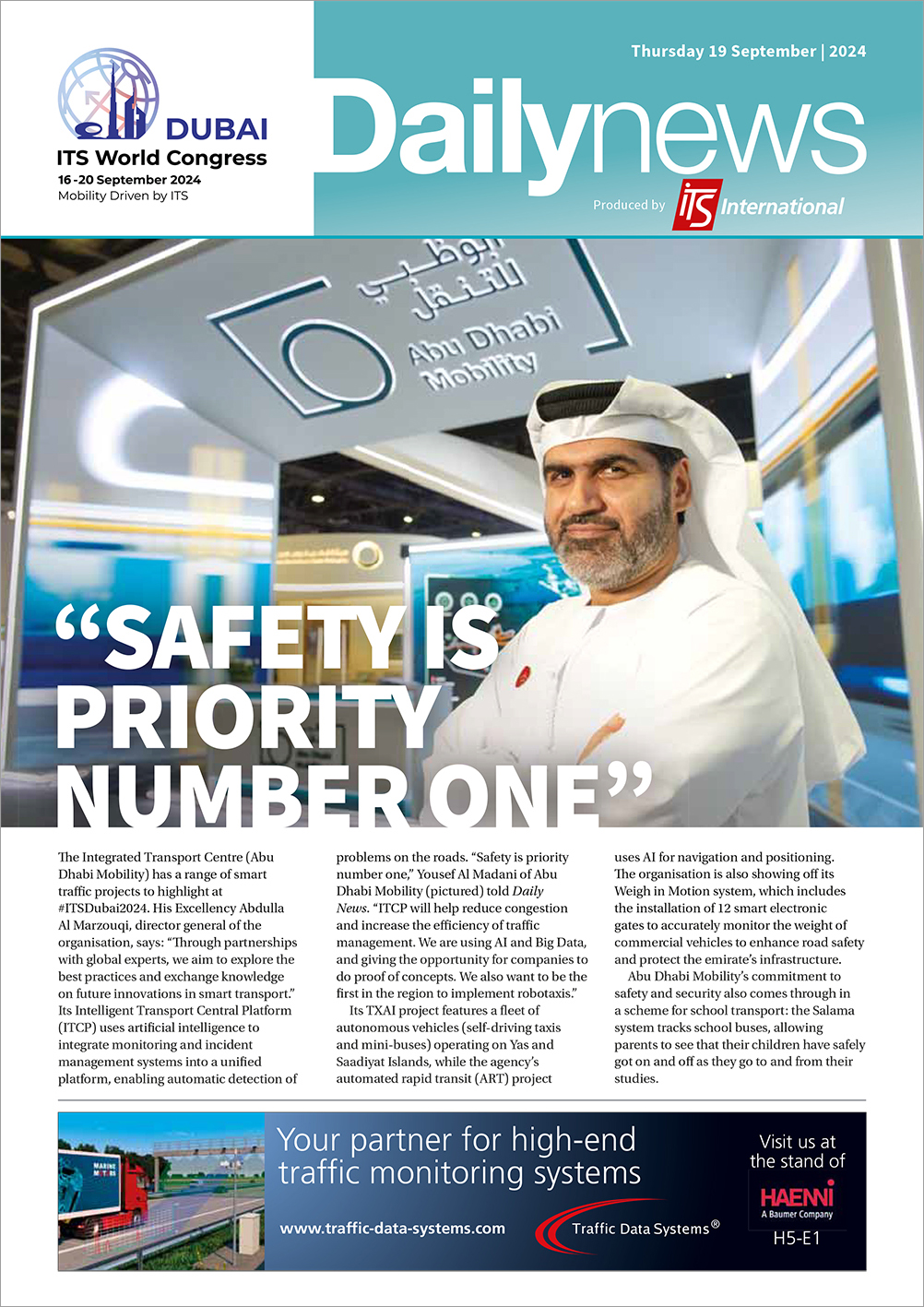
")
")

")