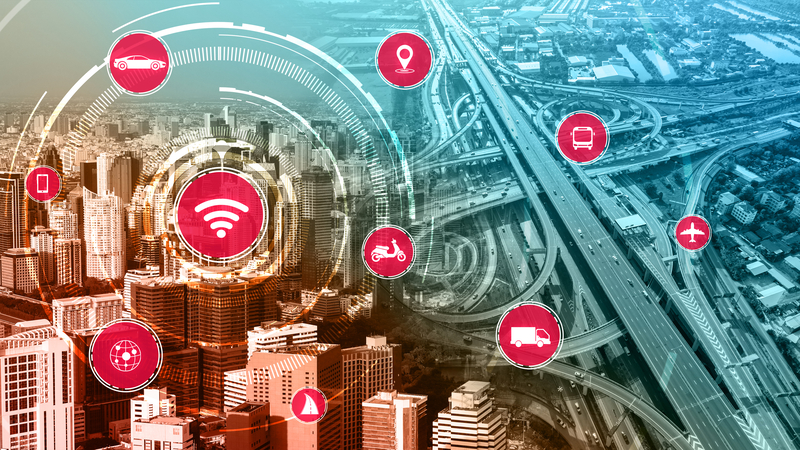
Some technologies burst onto the scene in a blaze of glory – but others have to wait until they get their time in the sun. Lidar has been around for decades, yet only now is it coming to prominence in the ITS industry.
As Innoviz Technologies CEO and co-founder Omer Keilaf points out: “It’s been used since the 1960s in aerospace and defence applications, in addition to city planning and road construction, for its mapping and detection abilities.”
Lidar has also been out of this world – sort of. “Its most notable adoption dates back to the 1970s in aerospace applications, where Nasa integrated Lidar for space exploration,” explains Akram Benmbarek, AEye VP of business development and strategic initiatives. “Airborne Lidar became popular over the 1980s and ‘90s to generate accurate topographical maps.”
But he suggests it wasn’t until the Darpa challenges from 2005-07 – to produce a driverless car which could negotiate an urban route - that autonomous vehicle (AV) developers recognised the critical importance of Lidar’s ability to capture high-resolution, accurate depth information and understood how Lidar complements the limitations of other sensing modalities like cameras or radar.
“The reason behind Lidar’s prominence in the hierarchy of sensing is the unique technical attributes that this laser-based technology enjoys,” says Benmbarek. “Lidar can reliably provide highly-accurate 3D data at long ranges in all lighting and most weather conditions. These attributes are not only important for AVs, but equally valuable for intelligent transportation systems where real-time 3D data from sensors equipped on city infrastructure can save lives, minimise congestion, reduce commuting times and improve the overall well-being of citizens.”
Increasing awareness
Eastablished Lidar specialist LeddarTech is perhaps less surprised than most by the rise of the technology. The company’s CTO Pierre Olivier says: “We’ve been not only advocating, but shipping Lidar in traffic and transport applications for over 10 years now. LeddarTech identified very early on that Lidar could add unique benefits over the incumbent offerings (inductive loops, cameras, radar). I think the key difference now is the multiplication in Lidar offerings in response to AD requirements is increasing the awareness of Lidar from the ITS industry - but also increasing the awareness of the ITS applications for the Lidar industry; in other words, the technology is more widely available and the potential customers are more aware of its capabilities.”
Steve Bird, CEO of Red Fox ID, points to a considerable increase in investment and development effort to develop a new class of sensor particularly for use by the automotive industry. “The first wave of new Lidar companies were all chasing the same dream, of becoming a supplier of choice to one or more of the automotive giants,” Bird says. “The automotive industry has been a key driver in both technological improvement but also in price reduction. Both of these are beneficial to the tolling and broader ITS market. I think for most of the early Lidar companies the reality of AVs is still some years away so many are looking for new markets for their products to help bridge the gap. Some will fail to make the transition and disappear, some will end up being acquired for their technology, and some will survive - the trick is figuring out who will be in the last category.”
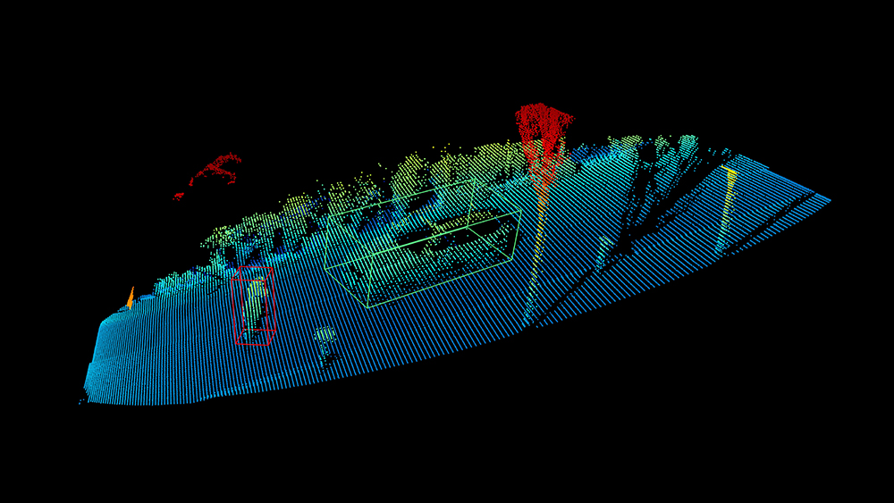
This is perhaps the point: even though its most eye-catching uses will be in the sexy world of driverless vehicles (and, let’s face it, space exploration which is pretty cool), Lidar has an obvious and useful place in traffic management. And of course, there is also the cost issue: Lidar has simply got cheaper over the years since its introduction.
“It’s more prominently used today because we are at a point where the price of the technology can go down significantly, making it accessible for traffic and transport applications,” suggests Innoviz’s Omer Keilaf. “In addition, Lidar performance continues to improve, demonstrating how its ability to identify objects in a scene and immediately measure the distance between objects is superior to other technologies.”
He cites highway driving as an example. “It poses a number of challenges — curved roads, multiple lands, poor weather, ageing infrastructure, low illumination — that must be accounted for to keep passengers safe,” Keilaf begins. “Lidar is the best technology to overcome these challenges because it can detect low-reflectivity objects at far distances, deliver high-resolution and produce quick frame rates simultaneously. This is important as the automotive industry shifts towards higher levels of driver autonomy — from Level 2, where the carmaker carries no risk because the driver is required to look at the road, keep their hands on the wheel, and engage if something happens, to Level 3, where risk shifts from the driver to the carmaker.”
Business disruptions
He argues that there is currently an “overconfidence” in Level 2 systems such as advanced driver assistance and points out that Innoviz partner BMW is using Lidar in its autonomous fleets, “without sacrificing safety and reliability”.
Dr. Florian Petit, co-founder and chief experience officer at Blickfeld, believes that Lidar has witnessed several significant technological and business-related disruptions in the past five years and is now entering a new phase. “Extensive research and test projects are being transformed into products and business cases,” he says. “This is a really exciting time, in which a lot of companies are well aware of the advantages of Lidar - like accuracy, reliability and 3D imaging of the environment.”
Companies are increasingly beginning to use the technology in a huge variety of applications, Petit says, “not only in the automotive and smart traffic areas”. But for Asad Lesani, CEO of Bluecity, Lidar is “the next turnkey solution, the next generation of traffic monitoring solutions”.
He briefly sketches out some history: vehicle control at intersections was working well but the growth of traffic created a need to provide priorities to cars on different approaches. “And that’s why we started using inductive loop detectors, which are a reliable system in different weather and lighting conditions - but they suffer from really high maintenance costs, installation costs and road closure requirements,” Lesani says.
Replacement technologies were based on radar, but these have their issues too. “For example, we can’t get multimodal coverage,” he goes on. “It’s mainly detection and speed measurement for vehicles without providing really detailed information about how cars are moving, how they are changing lanes.”
Over the last decade, Lesani has seen camera-based solutions getting more attention as a third generation of traffic monitoring “mainly because cameras can provide way more data than radars, including pedestrian detection, classification and tracking”.
But in many cases camera and radars are complementary: radar is good in different weather and lighting conditions, making it useful for traffic operation; cameras are good for multimodal but don’t work really well when it comes to snow, rain and murky light. There are also privacy issues with camera-based solutions.
“Even with camera and radar you still need to have multiple sensors at the intersection to cover your whole intersection - which again increases the cost of installation and maintenance,” Lesani continues.
Which brings us back to Lidar: Bluecity began looking at the technology in 2018 for monitoring traffic. “When we started, Lidar was expensive,” says Lesani. “We didn’t have high-resolution Lidar but we were pretty sure about the future: first of all, we can detect and classify different types of road users because we have enough resolution - unlike radar-based solutions. Second, we have reliable data in different weather and lighting conditions, which means that it works in snow, rain and low light and we’ve been testing it for the past three to four years in different projects with our customers across North America, Europe and Australia recently as well.”
Future mobility
Itai Dadon, VP smart infrastructure at Ouster, agrees that part of Lidar’s relatively new-found popularity comes down to a realisation that current technologies alone are not sufficient to achieve safety, efficiency and future mobility goals. “As exemplified by the rise of ‘camera-plus-radar’ combined solutions, the industry is realising that one legacy technology alone is not sufficient to power the mobility of the future,” Dadon says. “Cameras still suffer in low-light or inclement weather; radar often suffers with detection of smaller and slower objects due to its lower resolution. The result is the need for numerous detection systems to cover a single area for redundancy, or simply accepting that there’ll be gaps in the data.”
The next generation of traffic detection systems must go beyond the capabilities of cameras, radar and loops combined. “So just like autonomous vehicles manufacturers, cities are turning to a more advanced detection system: the Lidar,” Dadon adds.
It is a crucial solution for transportation applications that can enable a safer, more sustainable, equitable and efficient world, thinks Austin Wilson, Velodyne Lidar director of intelligent infrastructure. “Lidar users, such as municipalities, can monitor traffic networks and public spaces to generate real-time data analytics and predictions,” says Wilson. “This will improve traffic and crowd-flow efficiency, advancing city transport planning and protecting vulnerable road users. Previously-existing traffic solutions, based on radar and camera, do not provide the trajectory or 3D data needed to solve the biggest traffic problems the municipalities face today.”
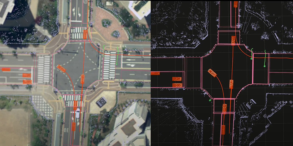
For Gerald Becker, VP, market development & alliances, Quanergy Systems, the only limit for Lidar in smart cities is now the user’s imagination. “Anywhere that you need anonymised data about people or vehicle movement, Lidar is a cost-effective, low-maintenance solution that provides reliable, accurate data to drive your most critical city infrastructure decisions,” he says.
The most common applications are to improve traffic flow and safety. “By accurately and anonymously capturing individual and vehicle movements within dense crowds and across large areas, Lidar technologies provide municipalities and government organisations with powerful data about intersections, roundabouts, roads, highways, parking lots and toll gates,” Becker says. “The rich object data generated by Lidar-based smart city solutions can be used to automate critical processes that increase road safety, reduce pollution by lowering the number of idling vehicles, and reduce commute time by improving traffic flow.”
Seoul Robotics CEO and founder HanBin Lee sums the situation up like this: “The reason Lidar is now feeding into other smart city, traffic and transportation applications is because the tech is becoming increasingly advanced, the scope for application continues to grow, and it’s replicable across the industry and able to be deployed in different cities in spaces without developing new proofs of concept.”
In addition to Lidar hardware rapidly becoming more affordable, Lee says that 3D perception software, such as Seoul Robotics’ own SENSR, is becoming more sophisticated. “It is easier and more accessible to deploy the tech in other industries beyond just AVs. The full 3D nature of the sensing technology allows for more accurate tracking results that meet the strict safety requirements of the ITS market. For smart cities, security and other industries, Lidar is becoming more popular for its ability to reduce the number of false positives significantly, work day and night in most weather conditions, and alleviate privacy concerns by not collecting biometric data.”
So why Lidar and why now? Simple, he concludes: “The nature of the technology is efficient and privacy-friendly, and with the historical barriers of software and hardware lowering, other industries are taking notice.”


