Missouri is a predominantly rural state with the second largest number of farms in the country and agriculture the main occupation in 97 of its 114 counties. US statistics starkly reveal how road accidents in rural areas tend to be more serious than in urban regions and of the 32,000 US motorists killed each year, 54% die on roads in rural areas even though only 19% of the population lives in these.
And these incidents are not confined to small backroads. Although rural interstates see fewer crashes than urban ones, they experience higher numbers of fatal accidents. Congestion on rural interstates is a growing concern for many US states, including Missouri, with rising traffic volumes impacting on intercity travel times. Furthermore, rural workzones cause particular issues because of the lack of adequate parallel alternative routes and long-distance drivers unlikely to be familiar with local conditions in the corridor hinterlands.
But change is possible as Missouri’s Department of Transportation (MoDOT) has shown – and collected a string of accolades for its traffic information initiatives - one of which extends the live traffic data-based driver warning systems developed for the main urban centres, to its rural interstates. Another has brought the department’s field staff and highway patrols up to the same level of traffic situation preparedness as their office-based colleagues.
Operational since January 2016, the new Rural Queue and Delay Warning System (RQDWS) has gained a Best Project Award from
Historically, MoDOT had enjoyed access to live traffic data only in its two major metro areas, St Louis, it major city, and from across the state border, Kansas City - both of which have a dedicated traffic management centre (TMC) (named Gateway Guide and KS Scout respectively). This partnership between the Missouri and Kansas DoTs formed as the population of Kansas City is split almost evenly between the two states.
In these two urban centres, MoDOT collects speed and traffic count information data from roadside sensors and keeps drivers informed of upcoming delays and congestion by setting advice on dynamic message signs (DMS). Its long-term ambition is to install comparable capability on its two main interstate corridors: the I-70 which links the two conurbations and the I-44 which runs south-westwards from St Louis to the border with Oklahoma.
As a starting point, in 2014 MoDOT contracted to gain access to GPS-based live traffic probe data as the basis for a rural system. In January 2016 KC Scout launched RQDWS along I-70 and Gateway Guide followed suit along I-44 in September 2016. The new system builds on MoDOT’s experience while taking advantage of the fact that less dense probe data remains relevant owing to the wider spacing of interchanges in rural areas. Mapping specialist Here collects and processes data from sources including mobile devices in cars, connected vehicles and fleets, and converts the results into speed and travel time data for each roadway segment.
It makes the outputs available as a XML-based web service, with a standard configuration file detailing the road segments. MoDOT polls the XML feed every minute, and integrates the results into its advanced traffic management system, which uses
This reads the Here data and compares it with preset thresholds for indications of slowed or stopped traffic. It then completes the processing necessary to determine when a queue warning message needs to be automatically posted to a rural DMS board.
Here’s James Etheridge stressed to ITS International that no new hardware is needed, saying: “it’s simply a feed.” Staff at the company’s US national traffic operations centre in Chicago can complement the probe-derived data from other sources including social media to build a better overall picture of traffic situations.
The system builds on MoDOT’s practice of delivering on-road traffic condition messages which have proved effective in reducing numbers of rear-end crashes resulting from fast-moving trucks suddenly encountering a stopped vehicle. The rural DMS are strategically located in pairs along I-70 and I-44.
Once TransSuite detects a speed threshold being crossed, it automatically formats and posts, on the first sign, a message giving motorists information about the possibility of encountering slow or stopped traffic ahead; if they do so, where they should expect it (referencing exit number) and what kind of delay to expect.
The system is based solely on Here’s probe data and works automatically regardless of the cause of the delay (an accident, a workzone, adverse weather conditions…). The ability to react to the last has enhanced MoDOT’s role in dealing with, for example, ‘snow fights’ between snowplough crews and the weather - “one of our most visible and closely watched services,” said Nelson.
Once a slow-down is detected, a TMC operator can initiate a response plan – posting additional guidance on the follow-up DMS and, if appropriate, dispatch a field team to the scene to deal with the problem.
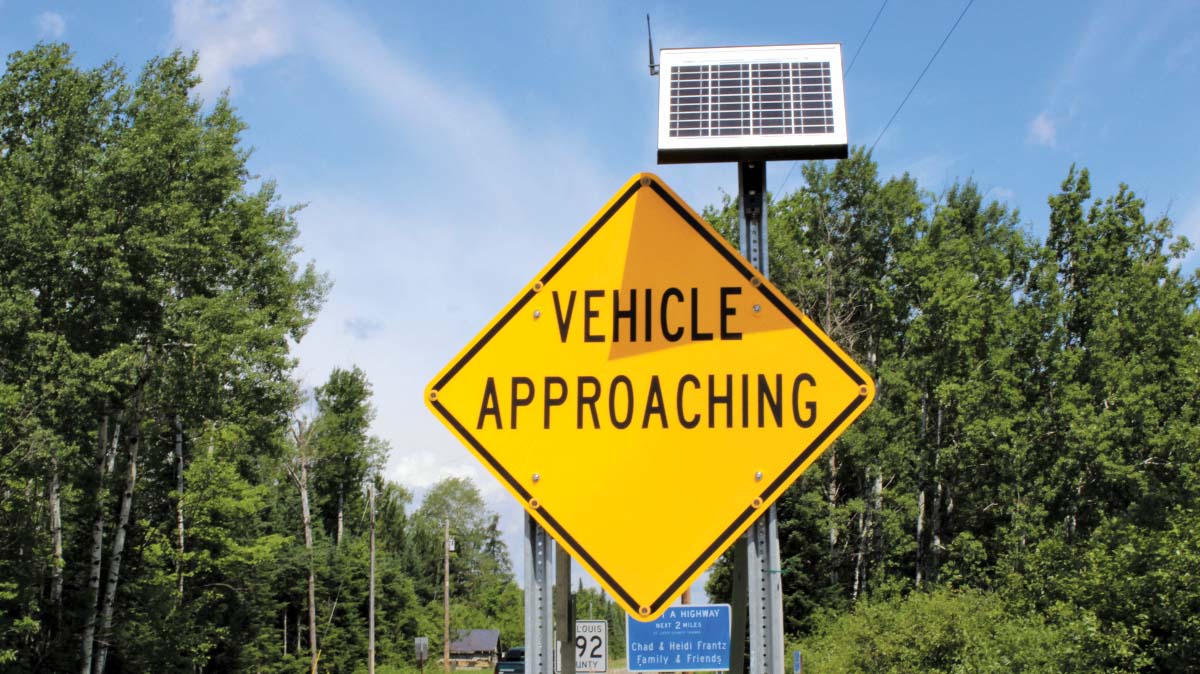
Another driver alert system supports the management of self-contained smart workzones at major road construction scenes. It uses smaller, portable changeable message signs (CMS - as MoDOT terms them) to warn of stopped traffic when congestion builds upstream of a site. These can carry shorter ‘slow traffic ahead’ or ‘zipper merge’ warnings (see box).
MoDOT’s workzone ITS is solar-powered and automated to enable the calculation and generation of realistic travel times for transiting the construction activity, 24 hours a day. The department says CMS has become “a major tool” in helping to reduce crashes.
It is now monitoring drivers’ satisfaction with the system via an online questionnaire, asking:
Did you have enough warning before entering this workzone?
Did the signs provide clear instructions?
Did you make it through the work zone in a timely manner?
Were you able to travel safely in the work zone?
Respondents giving negative answers to the last two questions are invited to provide additional detail.
In both general traffic and workzone scenarios, state emergency response and traffic incident management staff work closely along the two interstates with local jurisdictions, all of which can sign up to receive routinely generated incident alerts.
MoDOT also has plans to expand the new driver information approach to its other interstates - I-29, I-35, and I-55. Since traffic volumes on these are substantially lower, the workzone system is likely to be prioritised in advance of the next tranche of major road reconstruction being scheduled.
Here is currently also supplying traffic information to 11 other state DoTs. Etheridge told ITS International: “governments are interested in seeing how others have deployed the technology and Missouri definitely has some innovative approaches for them to leverage.”
Field alerts
When MoDOT began acquiring Here’s real-time traffic data, it initially fed the results into an online traveller information map, to keep staff and drivers updated on actual road conditions. While useful, in practice the map proved to be of most benefit to office-based employees with computer access. It soon became clear that staff working in the field needed a more proactive and convenient way to access the information. In response, MoDOT’s Traffic and Highway Safety division joined forces with the Information Systems division to develop an internal alert programme for sending out critical warnings.
The resulting Field Alert Traffic System (FATS), launched in April 2015, is closely integrated with the RQDWS. It allows MoDoT employees (and contractors) to sign up for coverage of specific road segments (for example, within a workzone) on which they want to be kept notified by text or email to their mobile phones, if speeds fall below a pre-defined threshold.
Registered users can opt to be updated on as many road segments as they wish, and control the criteria for receiving alerts (for example, by time of day, day of week or speed threshold). Once alerted, they can then investigate and decide on an appropriate response. MoDoT reports finding this system of great value in managing workzones and incidents.
FATS currently has some 200 users taking advantage of it in their day-to-day operations - Missouri state highway patrols as well as staff working for all three of MoDOT’s TMCs. The third TMC is at Springfield and gives local daytime support to Gateway Guide in the Ozarks region along the south-western section of I-44.
Nelson says: “Many times, these alerts have been the first notification an employee has had of adverse traffic conditions in their area of interest, and they can then respond more promptly. The cost of setting up the system was nothing for materials and 80 hours of labour.”
Zipper
Zipper is the name given to alternate vehicle merging and is currently the subject of driver information campaigns in several US states. This follows research showing that, in dense or slow moving traffic, resisting the temptation to change lanes at the first indication of an upcoming workzone can reduce the traffic backup by up to 50%.
Motorists are being told that using two full lanes of traffic until they see a specific instruction to merge will reduce the difference in speed between the lanes. When both of these continue to move slowly, all drivers are equally delayed and there is less risk of road rage.
Other awards
The RQDWS (and underlying existing systems) also won the 2016 Missouri State Governor’s Award for Quality and Productivity for the MoDoT’S technical group in recognition of their ‘ingenuity and customer-focused commitment’.
FATS, in turn, has won the 2016 Francis B Francois Award for Innovation presented by the
The department has also won a further 2016 AASHTO President’s Award for Research for the Road to Tomorrow team’s work in identifying potential sources of funding for the creation of an ITS testbed along the state’s tranche of I-70. Launched in 2015, the long-term project plans to invite commercial companies, entrepreneurs and innovators to come and stage trials of technologies that could include automated vehicles and solar roadways.
MoDOT hopes it will produce solutions that other US states will be able to benefit from. (See ITS International, November/December 2015).


