For highway authorities, getting a visual on traffic problems is a key way of sorting them out. Fixed camera technology is an obvious means to do this – but what happens if you want a bird’s eye view? Soarizon, part of Thales, thinks it has the answer.
Benjamin Orcan is open-innovation and strategic partnerships lead at Soarizon, a platform which aims to scale the operation of unmanned air vehicles by pulling together multiple sources of information to allow safe operation for operators and businesses.
To prove its concept, the company self-funded work for an unnamed client round Scotland’s M8 motorway, which connects Glasgow and Edinburgh. In particular it zeroed in on the busy junction 19, detailing the categorisation of vehicles, potentially dangerous driving behaviours, how often vehicles travelled through ‘high risk’ areas. Soarizon says the information it collected fed into traffic management measures, timings of events and wider planning. And its selling point is that sending up a drone is cheaper than fitting fixed infrastructure or relying on manned aviation.
Drones tend to come with good camera technology. “There was nothing, actually, particularly complicated in terms of data capture,” says Orcan. “What really is the differentiator in this type of service for us is the analytics that get applied to it.”
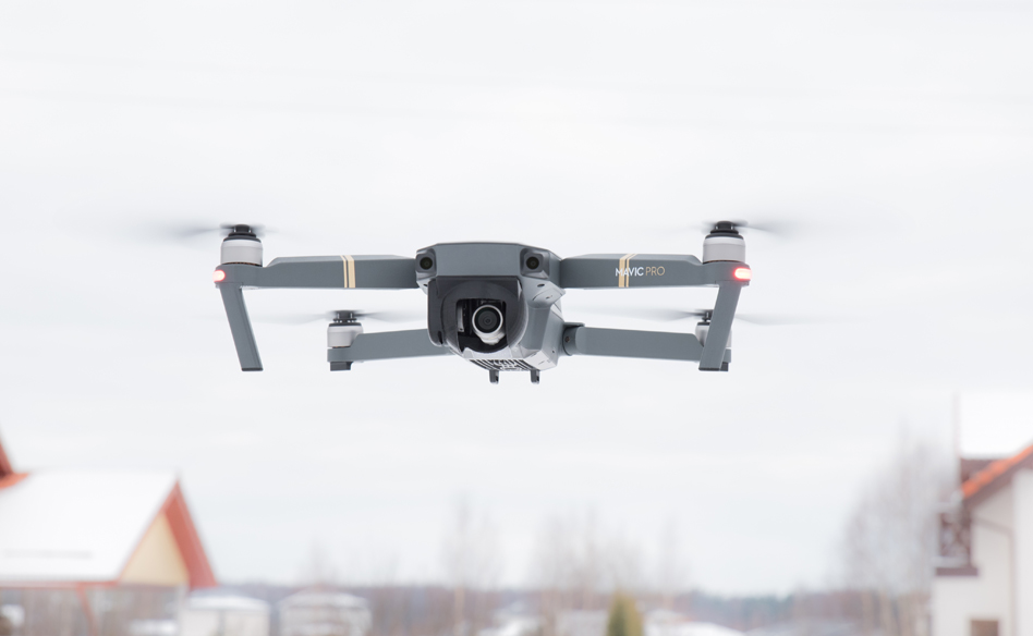
In this case, the drone used was a DJI Mavic Pro (which has 12.35 megapixels and field of vision 78.8°). “More complex use cases in the future, like cracks in surfaces, would essentially require higher-grade optronics equipment,” he adds. “But in this scenario, actually, it’s fairly standard off-the-shelf stuff. The thing that’s really interesting or valuable about the imagery we were able to collect is probably more about the vantage point.”
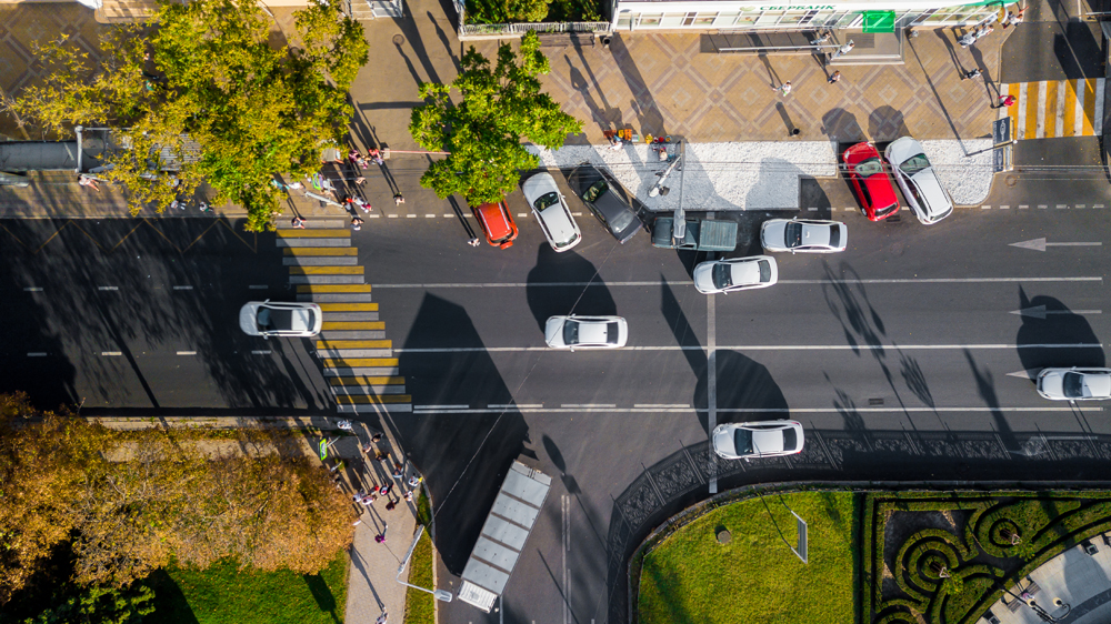
In a lot of current transportation systems, there is a ‘blinkered’ view, he says. “So you’ve got loads of fixed cameras that are on the network in various positions, but they’re not hugely flexible: they’ve got some rotation, but really, the angles are fairly fixed. What’s good about the drone imagery that we’re able to collect is we can get a bird’s eye view, we can get all sorts of different angles. And in the M8 example, you can cover quite a large area and pick up lots of different things in one picture. Part of the game-changing piece about drones is you can adapt the field of view, and you can capture in one image, or in one stream, lots of different things. There’s a real paradigm shift, really, in what the art of the possible is.”
Fixed restrictions
Human traffic counters and fixed cameras are restricted, he argues. “But if you have a drone in the air, you can look at five, six, seven different things at one time, with the right analytics supplied or with the right time dedicated to it after the fact, and you can pick up a hell of a lot more. And that’s really what we were looking at and trying to prove with this: is there value in using drones over and above the fixed camera network? You know, people going out and surveying getting actual data once or twice a year for a junction like this? Can you get better data? And that’s really what we think we’ve shown here.”
Traffic management is an obvious market for Soarizon. In the UK, traffic modelling capability is very strong, he says. “But getting the actual data that underpins that modelling is very difficult and often it is very expensive to do so.”
Drones are particularly useful in what Orcan calls ‘ad hoc’ situations. “One of the use cases we identified was when it comes to event planning,” he goes on. “Can we do some upfront analysis of the anticipated areas that will be affected and use that to specifically predict and manage the impact on the road network?” Maintenance needs and network planning are other examples, he says.
In the case of junction 19 of the M8, next to Glasgow’s SEC arena, it was a known pinch point. “So we’re looking at this area, trying to identify what can we learn here? What data can we capture that’s going to help to plan to mitigate those kinds of problems in the future?”
Getting the imagery is one thing: what you actually do with it is quite another. Soarizon’s drone pictures were not transmitted in real time; instead they were collated and sent to partner Transpix for processing. This AI start-up applies intelligent algorithms to road traffic data, deriving usable insights which can then be plugged into end customers’ modelling software.
Transpix took three or four days to turn the data around but Orcan points out that this could potentially be done in real time in future. “In this stage of the project, we were looking at proving that you can go and capture this level of quality of data,” says Orcan. “It’s fairly efficient, it’s fairly quick, and it’s fairly cost-effective against traditional means.”
Soarizon sees the next step, once people are aware of the quality of data available, is to look at partnering with service providers, or simply offering the outputs to users. “It’s really open,” says Orcan. “Everything is possible in this digital space. So it’s really about what’s valuable to those customers.”
On-demand service
Soarizon’s business model could see a fleet of drones which would be kept on a client’s retainer to look at ongoing traffic problems or – as in the M8 case – simply used to sort out a specific problem which a customer had identified. “The answer is both,” Orcan says. “There are loads of operators on our existing platform that we can access, we can trust, and we can distribute missions to; in the long term, what we envision is a far more on-demand service that is accessible.”
These could be at pre-defined price points with clear service-level agreements, perhaps along the lines of a Netflix or Uber model. “It’s where most companies are going to go with their services,” he predicts. “You’re even seeing car manufacturers like Volvo now doing subscription services for cars.”
And so to the bottom line: Soarizon says that it’s a cheaper option – but how cheap exactly? “That’s an interesting question,” Orcan says. “Clearly it’s linked to scale. A one-off is obviously not going to be as cheap as it is doing the whole of a county, for example. But I think people would be quite surprised; the kind of day rates on these things are fairly low.”
While he does not commit to giving numbers he insists it is “competitive with existing collection methods”. Output is more accurate and better quality “so we think it’s at least as cost-effective as existing means of data capture”.
He emphasises once more his point about fixed infrastructure only covering certain angles and certain use cases. With drones, he says: “It is the higher level of information that you get, the quality and the quantity of data, and also the fact that it’s actual. Usually, we would get people predicting traffic flows and traffic counts, and they would extrapolate that over time; what we can give is 100% accurate data, because what we’ve done is take the footage and apply analytics to it. But you’re also capturing, probably, six or seven data points where a human can probably take one or two.”
On the M8, Soarizon was able to look at “lane counts, turn counts, driver behaviour, we were able to look at how many cars actually got through each green light”.
The client was certainly surprised that basic drones could pick up such a variety and depth of data, Orcan concludes. “All those insights came from one camera up in the air. So we’re getting far more in terms of how many different data sets from one operation. It was really the piece of how many different things the cameras can pick up in high quality and how much the AI can pick up. You know, rather than just one or two different parameters, the fact that you can pick up seven or eight different parameters on the same image - and it’s such a broad scale. That was really the thing that they were quite impressed by.”


