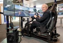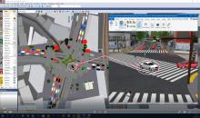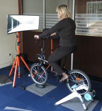
Japanese interactive 3D simulation and modelling software specialist
It demonstrated the mini-drone on Tuesday night at the Nouveau Stade Bordeaux, adjacent to the Exhibition Hall.
MAPSs, which uses a small, remotely-piloted DJI Phantom 3 quadcopter, maps a predetermined area by flying via GPS waypoints. Forum8 describes it as a low-cost method of producing a range of Geo, GIS and 3D Interactive mapping products and city models.
Flight time is up to 10 minutes, depending on weather and battery capacity.
During that time, the cameras mounted on the drone take between 500-700 photographs, which are then processed by Mitto Design of the US.
The resulting imagery can be processed to create 3D point clouds, real-time interactive 3D virtual reality simulation models or digital terrain maps.


