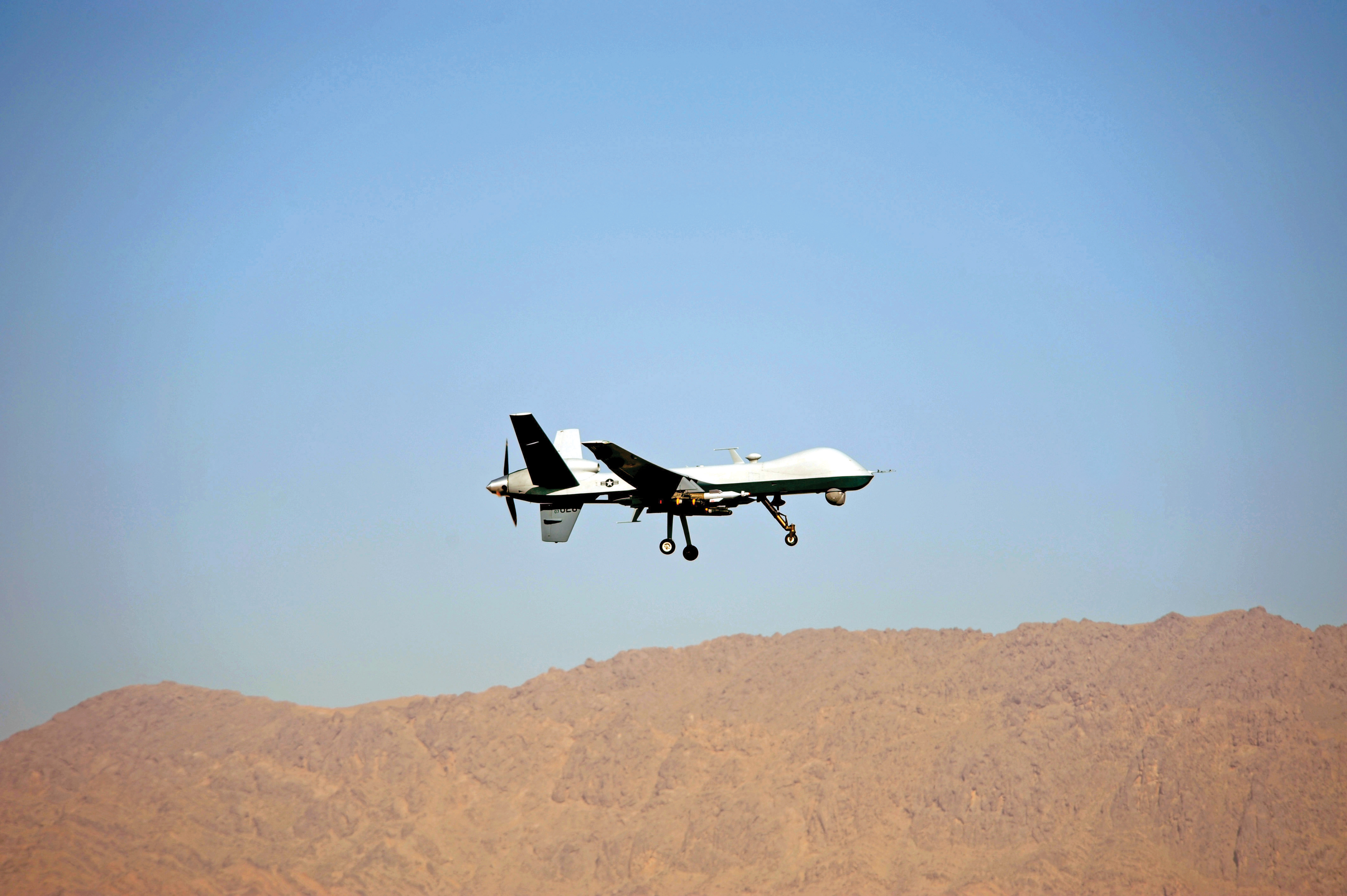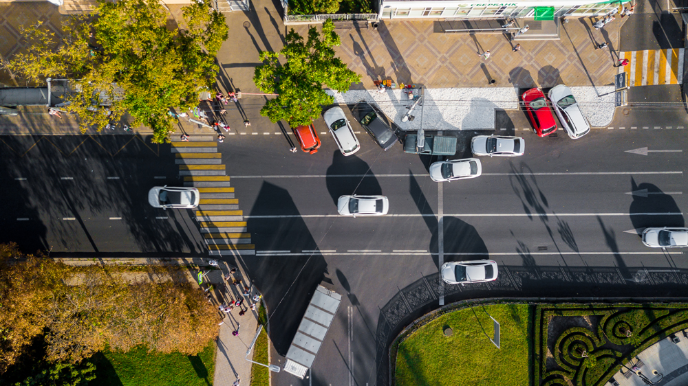
A new frontier in the quest to monitor road traffic is opening up… but using airborne drones to reduce the jams comes with some thorny issues. Chris Tindall reports.
Imagine if you could rely on a system that provided all the data you needed to regulate traffic flow, route vehicles and respond swiftly to emergencies for a fraction of the cost of piloting a helicopter.That system exists, but as engineers and traffic managers start to explore the potential of
Research into drones for traffic management purposes is still in its infancy but tests have been conducted, notably in Ohio in 2003. In a State University experiment, a UAV with a payload of two video cameras flew at an altitude of 150m (492ft) for almost two hours, while transmitting video images to the ground.
A subsequent paper detailing the results noted how level of service, intersection operations, origin-destination flows, estimations of average daily traffic and car park utilisation were demonstrated during this time.
Project researcher and university associate Professor Benjamin Coifman says the project achieved its goals and showed that UAVs could be used to collect real-time traffic data.
Coifman says his team continued working on a follow-up to this test, but the focus shifted to other topics. “One of the biggest things that put a halt to our efforts was a rule change at the FAA [Federal Aviation Administration],” he says. “They basically prohibited civilian UAVs for any purpose. That change came shortly after our demonstration flights.”
But this restriction may be about to be overhauled.
In February 2012 a law was passed in the United States that required the FAA to start permitting the use of drones by, among others, commercial organisations. The FAA must have rules in place that can allow their use by private firms by the end of 2015 and this is expected to pave the way for thousands of drones to take to the skies.
Crop monitoring, fugitive tracking, land management and news reporting have all been cited as uses, but their role in future traffic management is also being investigated too.
European experience
In Europe, theUsing figures derived from the German Automobile Club, it said the average driver spent 65 hours per year in traffic jams, which represented 40m litres of fuel consumed daily and resulted in a cost to the country’s economy of €100bn-€200bn.
DLR argued that a solution could come in the form of cameras and radar sensors on “high flying platforms” that would monitor infrastructure and road traffic situations, including away from the motorway network where there are no overhead sensors. “One single platform could support traffic planning or could operate for monitoring big events or even can be used for calibration of terrestrial sensors,” said a DLR review paper. “Possible platforms are aircraft and satellites and even zeppelins, balloons, or UAVs flying at high altitudes.”
International drone trade association the Unmanned Aerial Vehicle Systems Association says commercial uses of drones are not limited to traffic monitoring.
John Moreland, general secretary, says this use actually sits at between 30 and 40 in the rankings of current commercial interest, but he adds that it still has its attractions.
“A UAV’s primary role is not for flying, it’s for collecting data, or information. In terms of traffic management, the key thing is that the highways agency, or local traffic planners, want data – and don’t care how they get it. A UAV is a hell of a lot less expensive than a helicopter or an aircraft.
“Satellites are also expensive pieces of kit; probably £100,000 a day,” Moreland adds. “A UAV would be between £1,000 and £2,000 a day. That’s the difference.”
Like their counterparts across the Atlantic, European companies and governments are keen to profit from drone use and a European Commission working paper released last September extols the benefits of “Remotely Piloted Aircraft Systems” (RPAS) and claims 400 RPAS are currently under development in 19 member states.
The paper also urges their introduction in European skies by 2016, adding: “The United States of America has recently approved an ambitious plan to insert RPAS in the national airspace by 2015. Europe should not lag behind. There is an urgent need to develop agreed European objectives for unrestricted RPAS operations in the Single European Sky.”
Moreland says the UK is ahead of the game when compared with the rest of Europe, explaining that there are as many as 150 organisations licensed to operate a UAV up to 400ft. At that height, you can expect to cover more than half a mile of road network with resolution down to two centimetres.
It’s when you start to push further up into controlled airspace that problems emerge. “We are a fairly cluttered part of the world,” says Moreland. “In terms of getting near a big city, conurbation or airport you can’t fly them. Even 60g of metal can bring down an aircraft…”
Privacy concerns
But this is not the only problem drone advocates are facing. Support for their introduction may be growing, but so is the clamour of anti-drone campaigners, deeply alarmed by the impact on people’s privacy.“Some people are anti-military and they don’t want to see that application any closer to home than they are at the moment,” admits Moreland. “And people are very concerned about their privacy.
“The privacy concern I fully understand. The paparazzi have used them in America. [However] It’s not the taking of the photo or the image that’s the problem, it’s what happens to it next. But it’s becoming a way of life these days and it’s the way we are going.”
Chris Coles, co-ordinator at
“There does seem to be huge political pressure to open up UK airspace. Drones would be hugely cheaper than helicopters, but what’s going to happen to all the data that’s captured? There’s no forum where this issue is being looked at. Everyone needs to take a breath and ask what the implications are.”
Coles stresses that he is not against their use per se: “Make no mistake, there are good uses of unmanned systems – traffic management and search and rescue, for example. We are not arguing that all drones are evil, but there has to be proper regulation and proper control.”
Ultimately Moreland believes UAV applications will be limited to extreme situations, for example when a bridge collapses, and coordination between police, ambulance service, fire brigade and even the coastguard is vital.
But he also says that over the next 10 years, low-level drones will probably start being used for matters such as local government enforcement: street parking, planning permission and building regulation, for instance.
“Once you have gone from local stuff we will see a small number of much larger systems being employed by the Home Office, or the emergency services, in national coverage for traffic management,” he adds.
And while the underlying technology for commercial drones is the same as that relied on by the military, the future is likely to be based on autonomous vehicles. “My understanding is that drones flying in civil airspace are autonomous, not remotely controlled,” says Chris Coles at Drone Wars UK. “In a few years remote control will be history. This is just the beginning.”
FLOWING TECHNOLOGY TO THE MILITARY
While there are many examples of technology flowing from military to commercial use, such as drones, the flow does sometimes go the other way – indeed there are several ITS technologies currently being adopted by armies around the world to solve transportation challenges, including in the US.
A paper published in September 2012 outlined the US Army’s interest in systems that allow drivers to scan and analyse their surroundings in hostile environments; in effect, allowing their service personnel to embrace distracted driving. They included Convoy Active Safety Technology and Unmanned Ground Vehicle systems.
Both demonstrated how they could free up the numbers of drivers needed and improve safety and operational efficiencies.
Co-author Sara Blackmer, director of government markets at US-based Pratt Miller, says the technologies of interest include adaptive cruise control, which maintains speed and distance from a vehicle in front, as well as obstacle avoidance and safety override systems, and driver alert systems that warn drivers of problems such as lane departures.
“Any ITS-related technology that can help enable distracted driving is of great interest to the US military,” comments Blackmer.
“Basically, for overseas applications, they are interesting in exploiting opportunities where the ‘mundane’ tasks related to driving can be reduced or eliminated so service members can focus on the mission, including improvised explosive device detection.
“For stateside applications, they are looking for opportunities to help manage traffic congestion on bases and prevent service member deaths from vehicular accidents,” she adds.


