A project aimed at proving the viability of satellite-based goods tracking in Europe has come to a close – establishing everything necessary for commercial services to flourish
Alandmark stage was reached in tracking of goods across Europe in December last year, with conclusion of the Scutum project – ‘Securing the EU GNSS adoption in transport of dangerous materials’. This has validated the accuracy and reliability of the European Geostationary Navigation Overlay Service (EGNOS) for goods tracking and set a technical standard for commercial services using EGNOS. Closure of the EU-funded Scutum initiative represents a start rather than an end point for industry and theSpeakers explained as much at a final meeting of the Scutum project at the Rome headquarters of the Italian energy and oil company eni in December last year, following presentation of the project’s results at the annual European EasyWay forum in November, also in Rome. Italy has been represented strongly, but not exclusively, in the Scutum developments. France has also participated – one of four countries represented by 11 Scutum partners, which also included the European Road Federation (ERF). A key point made by many in Rome was that opportunities have now opened up for tracking of goods – hazardous or otherwise – transported by road and rail across Europe.
A key output from Scutum, via associated research and development projects by its partners, has been verification that EGNOS technology can provide the high levels of accuracy and reliability needed for commercial tracking services. Furthermore, Scutum has cemented in place at least some of the ground-based technology needed for use of Europe’s Galileo navigation system. Two test satellites of Galileo were launched in 2011 and a further two are due to be launched this year – as part of a constellation that will ultimately number 30. An initial array of 18 satellites needed to make Galileo operational is expected to be orbiting after 2014.
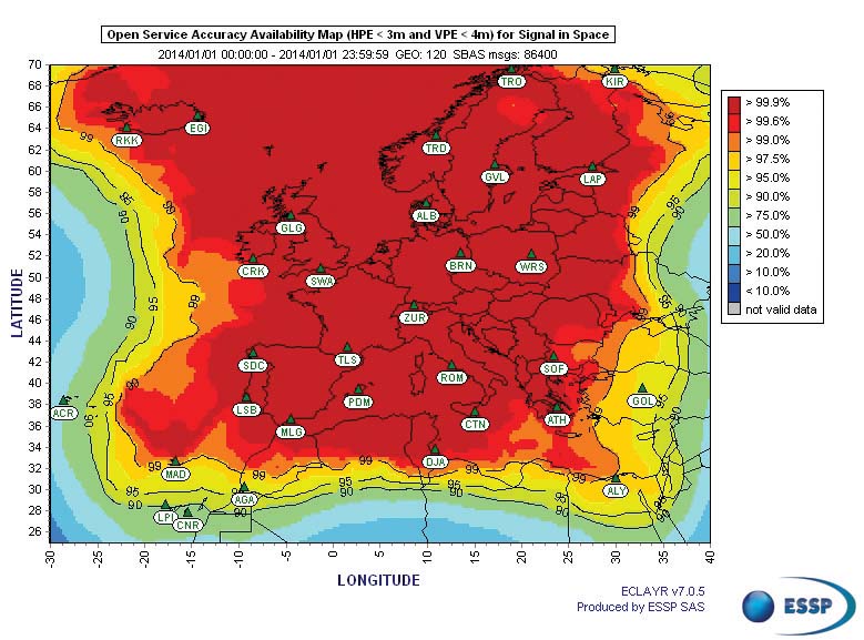
Prior to that, the basis for EGNOS is a free-to-use positioning system that makes use of three geostationary satellites and 40 ground stations located across Europe – the EGNOS Open Service (EGNOS OS). During a precursor project to Scutum called Mentore, a number of pilot schemes were established to test different uses for EGNOS. “This was done to identify the application with the best natural fit – that which could benefit most EGNOS and had greatest potential for development of a fully fledged commercial tracking service,” says ERF’s project manager for Scutum Irene Fusco.
All of the Mentore applications were in transport, including travel for the disabled and movement of livestock and light goods. Tracking of hazardous materials – ‘hazmat’ – emerged with greatest potential, however, partly because of the large amounts of useful data that can be extracted by materials suppliers and their logistics operations for safety and fleet management, among other things.
Step forward eni and the satellite technology specialist Telespazio. It was eni that piloted hazmat tracking for the Mentore project, with a number of its delivery fleet fitted with EGNOS satellite navigation receivers. The energy, fuel and chemical products supplier operates a fleet of around 1500 vehicles, directly or through transport contracts. Its logistics operation includes monitoring of delivery movements, vehicle performance and driver behaviour as part of an overall strategy aimed at health and safety and environmental targets.
Measuring delivery contractors’ success with meeting their contractual obligations is a big part of this. The entire eni fleet is monitored centrally by the company’s Transport Integrated Platform (TIP) which takes in data from sensors on vehicles, measuring driver behaviour, engine performance, loading characteristics and delivery operations.
Communication of the information to the TIP has conventionally been via GPRS and telecommunication networks with trucks located via GPS, with a fair degree of success, albeit limited in reliability and accuracy for effective review of service from delivery contractors. “In the course of Mentore, eni and Telespazio proved EGNOS gives more exact positioning data, improving on GPS accuracy,” Irene Fusco says.
From there several further and significant leaps were needed to create the conditions necessary to allow commercial tracking services for public and private sector markets. Even greater accuracy was required, crucially with the strong levels of validation and audit trail needed for standing up to the legal scrutiny of commercial operations – with standardisation set to allow regulation of tracking services.
The ensuing Scutum project was established to aim for these goals: to set up, pilot and validate a commercial service – EGNOS CS – and then use the results to form a technical specification for tracking technology and service providers. Key to this has been the setting up of the EGNOS Data Access Service (EDAS) by the European GNSS Agency for providing controlled access to EGNOS data. Essentially a group of servers, EDAS distributes raw positioning information via terrestrial cable and wireless communication networks, in what is close to ‘real time’ with a guaranteed minimum delay.
Again, eni and Telespazio were the lead private sector concerns involved in Scutum. This time around, however, EGNOS positioning data from eni fuel tankers was received and distributed via EDAS to Telespazio acting as the ‘value added service provider’. A further important link in the chain is the main contribution of Telespazio’s R&D efforts – its proprietary location server LCS.
“This processes data from EDAS and provides qualification and guarantee of the positioning information,” says Telespazio GNSS and Mobility Unit programme and project manager Antonella Di Fazio. The result of LCS is EGNOS position accuracy enhanced by 4m in comparison to GPS, with the ‘horizontal protection level’ needed for qualification and guarantee of the position data.
According to Di Fazio, LCS is a plug-in solution for ‘enabling’ the setting up of commercial services supplied via EGNOS and EDAS with existing GPS or EGNOS receivers. “The LCS is suitable for many different transport applications,” she says.
Work of the
The extent of willing and commercially viable markets existing in potential and how much they will emerge remain as unknowns for now, although eni at least has continued with its mantle of best practice in satellite-based tracking for fleet management. Around 300 of its vehicles are now monitored with EGNOS via LCS.
The Scutum partnership
Italian, French and Austrian organisations were the main contributors to Scutum. Its principal industrial partners and the companies with the strongest ongoing concern with goods tracking by EGNOS are eni and the Italian satellite technology specialist Telespazio (via its parent company, French subsidiary and e-geos partnership with the Italian Space Agency). These firms operate throughout Europe however. Other Scutum partners were the CEN European standardisation committee, the Italian Ministry of Infrastructure & Transport, the European Road Federation and the
According to Irene Fusco, the majority of ERF’s work with regard to Scutum – including the role of chair of the relevant CEN standards committee – is done. But, she says: “As dissemination leader, the ERF is supporting final communications stages. The results of Scutum will be presented at the 2012


