Canadian developer of photogrammetry software,
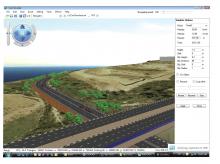
Correlator3D performs aerial triangulation and produces dense digital surface models, digital terrain models, point clouds, orthomosaics and vectorised 3D features. Powered by graphics processing technology and multi-core processing units, Correlator3D is said to have the processing power to support rapid production of large datasets.
The new release includes a redesigned aerial triangulation module while tie point extraction and bundle algorithms have been further enhanced, along with the added capability to address problematic input data such as low overlap projects.
The release features an alignment tool which automatically registers new projects to older mosaics and DEMs. It removes the need for recollecting ground control points and, in addition, a new semi-automatic workflow has been developed for ground control point tagging.
SimActive’s latest software processes data from satellite, UAV images
Canadian developer of photogrammetry software, SimActive, has released the latest version of its Correlator3D patented end-to-end photogrammetry solution for the generation of high-quality geospatial data from satellite and aerial imagery, including unmanned aerial vehicles more commonly known as drones.


